|
|
We welcome you to our 2nd quarterly Newsletter! Thank you for your support and feedback on the ORURISA's 1st quarterly Newsletter - July issue. Through your valuable feedback, we received overwhelming support and some great ideas. We have incorporated your feedback into our 2nd edition. We aim to explore, expand, and reshape the content of forthcoming Newsletters together, to meet the needs and add value to ORURISA members.
We hope that you will find great value in its content and that it will aid you in your own goals to grow and thrive. |
|
|
|
|
|
|
This year has been a year that, like almost everyone, I will never forget. Many days have been extremely challenging in light of the new norms and the bewildering experiences I see so many people facing on a daily basis. Simultaneously, 2020 has presented me personally with opportunities for renewal and rededication to what I value most, as well as the gift of additional time to reflect about where I have been -- my history-- and where I am going in the future.
In this year’s second newsletter, you will find opportunities to recount some of ORURISA’s history with Chris Wayne’s update from the Klamath Basin and follow Heather Sauerland through her journey to GIS. Looking forward, we offer a free online summit for ArcGIS Portal users in mid-November and GIS in Action in the spring. Please also meet new Board of Director members John Ruffing (At Large), Alicia Milligan (Emerging Professionals President), and Nikki Hart-Brinkley (Southern Oregon GIS Users Group), and lend a warm welcome to President Elect Keith Massie. Keith will assume the President role during the 2021 GIS in Action conference. Finally, learn about the Board of Directors’ recent planning retreat. We received much positive feedback in response to the July newsletter. Thank you for your kind words and great ideas! I hope that you enjoy what is presented here and that you’ll continue to help spread the word about the depth and value of our GIS community and to grow your connections to each other. |
|
|
ORURISA Board Of Directors Holds 2020 Planning Retreat
By Theresa Burcsu, ORURISA President
This month, the Oregon and SW Washington Chapter of URISA’s Board of Directors (aka, ORURISA Board of Directors) dedicated itself to taking a big picture look at our organization as a whole and a good hard look at what we’re doing for you, our members. Over the course of three, 2-hour meetings, we examined activities and trends inside and outside our organization and the GIS community we serve. We worked to come to a consensus about what we seek to accomplish as a Board to support ORURISA members and further the organization.
During the series of goal-setting meetings, we looked closely at three organizational areas: people, programs, and finances. People are primarily our members, the people we serve. People can also include partners, contacts, and the Board of Directors. Programs are the activities that ORURISA performs to serve our people and facilitate positive benefits. Our finances are the cash flows into and out of the organization that enable us to host events, sponsor activities, maintain our communications channels, and maintain our non-profit status. Using these guideposts, we developed a handful of goals that we will be endeavoring to meet over the next 1 to 3 years.
In the area of people, we are keenly interested in strengthening our current membership through outreach and enrichment activities. Part of this work requires taking stock of who is participating and why. We also committed to promoting diversity and inclusivity throughout ORURISA by laying the groundwork for real progress with clear actions and metrics, including board diversity.
Our programs discussion landed with a crystal clear focus on the OneURISA concept developed and distributed by our parent organization, URISA International. The concept seeks to unite all URISA chapters under the URISA International parent organization. Many other nationally and internationally-based organizations use this model in which the parent organization plays a prominent role in organizational development, continuation, and outreach. The concept has been under development by URISA International for over 10 years, and has come to a head with a 2021 decision deadline for Chapters to “play” or “cut bait." The decision has the potential to impact ORURISA tremendously in the three focal areas (people, programs, and finances). We are committed to understanding the impacts and examining the tradeoffs with the level of focus and intentionality this weighty decision requires.
As a result of the pandemic, ORURISA, like so many other organizations, has been forced to reexamine our cash flows. The result is two financial goals that will have long standing positive benefits: diversifying our revenue streams and increasing our financial transparency. By creating a more diverse revenue portfolio, we will be able to meet your needs with increased ease. By increasing the transparency of cash flows, members and directors will be able to make decisions with the best available information.
The board will spend the rest of 2020 refining our action plans and initiating the work that will lead to the accomplishment of our goals. Members are welcome and encouraged to attend board meetings and to join us in our efforts as volunteers. Please contact us if you’d like to be involved at contact@orurisa.org. |
|
|
|
|
|
|
Sections And SIGS
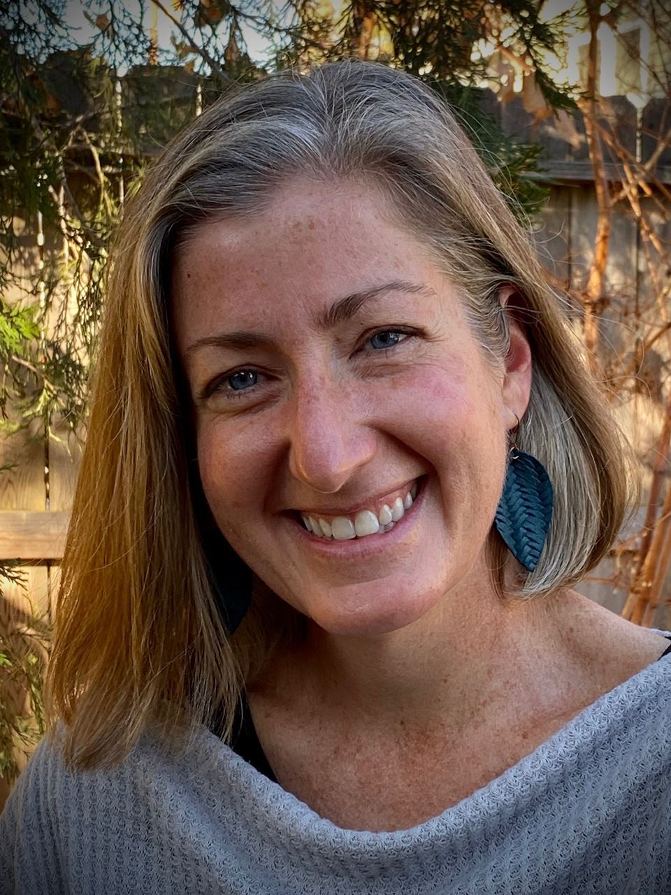
Update on the Klamath Basin Users Group by Chris Wayne.
KBUG was started in the late 1990s by Dr. John Ritter, a GIS program leader and professor at the Oregon Institute of Technology in Klamath Falls. Our membership includes local professionals in federal, state, county, and local government and faculty from OIT. However, our greatest asset is the students-- the emerging professionals-- who attend our meetings. (They're all very busy, but we lure them in with pizza.)
We host a map contest every spring, where the "grown-ups" judge the students' capstone cartography projects. The winners get to go to GIS in Action. Their maps have won several prizes there and at the PSU Cartography Symposium in 2018. We have also hosted several GIS Day Events, including one attended by people from local non-profits, the National Park Service, OIT faculty, and other interested parties.
We haven't had any events this year for obvious reasons, but we're looking forward to continued interaction between professionals, faculty, and students. These young women and men are our future, and it is a privilege to guide them along their journey. And it is a ton o' fun! |
|
|
|
|
On Demand
In the last quarterly newsletter feedback we received an interest for the webinars on the QGIS topic. QGIS presentation by Karsten Vennemann
Karsten Vennemann is a Principal and GIS Consultant at Terra GIS Ltd, Inhaber Terra GIS Deutschland
About the presentation: The combination of QGIS with spatial databases such as Spatialite, Geo package, and PostGIS allows for creating dynamic GIS layers. A simple example is adding to QGIS a layer based on a database view in PostGIS (or Spatialite). Such database views can include any of the geospatial functions available in the database via their data definition (SQL) query. Adding to the complexity and flexibility of this usage, such a database view can include references to multiple layers and include geospatial functions (such as buffers or geometry intersects), and include joins to custom functions allowing for very flexible use cases. In the talk, I will give a short overview of the general concept and show multiple live examples of dynamic content layers based on (the editing of) a regular database layer.
|
|
|
|
|
|
|
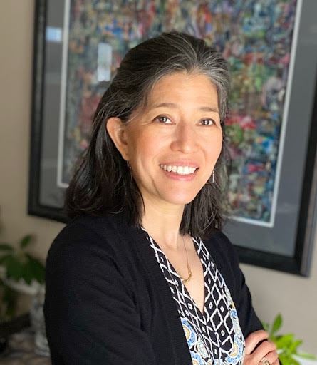
Celebrating Women In GIS: Heather Sauerland By Heather Sauerland
My name is Heather Sauerland, and my journey to GIS is a winding one. It started during my undergrad at the Clarion University of Pennsylvania. I studied biology with an emphasis on animal science and was told, “GIS is where all of the jobs will be in the future.” Being naïve and young, I thought hands-on work would be my contribution to conservation, not genuinely appreciating at the time how important data collection and analysis is to that conservation. After graduating, I spent the next ten years exploring national parks in the summer and skiing in Colorado in the winter, developing my love for the outdoors. I would spend hours searching the maps pinned to my walls for clues in the topography that would point me to some Shangri-La not mentioned in guidebooks. Finally, after a colleague recommended GIS as a career change, I enrolled in a certificate program in GIS at Central Oregon Community College and graduated in June 2019. I am currently employed at ToPa 3D as a Geospatial Technologist.
I think my story as a female in GIS is typical. I am the first-ever and currently only female at my company. Our current contract has us on a large construction project, with females being in the minority. I would say that my biggest challenges come from internal pressure. Pressure to prove that I belong here, that I can carry all the heavy equipment that the men do, to feel like I need to know everything right now. But the sign of a true and humble professional is knowing when to ask for help, leaning into the team to work together, finding innovative solutions to problems, and being patient with the learning process.
My other challenge is one that is not unique to women. As any GIS professional knows, this industry is vast and ever-changing. There is so much to learn constantly, and my first job out of school looked nothing like I expected it to be. Since starting with ToPa, I have earned my sUAS remote pilot license and fly each day. I have learned more about GCP’s and local customized coordinate systems than I ever thought, and have retired my school computer because it cannot handle the 3D data that we work with daily. These tasks have required me to learn about new software like FME and QGIS, expand on my knowledge of LiDAR, and experiment with 3D modeling and photogrammetry.
This field of study is an exceptional one. You really can use GIS in any industry and shape a career based on your interests. My advice to women or anyone looking for employment is to find a team that promotes continuing education, values open and honest communication and encourages collaboration and sharing of knowledge so that all may benefit. Finally, we are a diverse and active community, consider mentoring and lifting the next generation of women in GIS. |
|
|
|
|
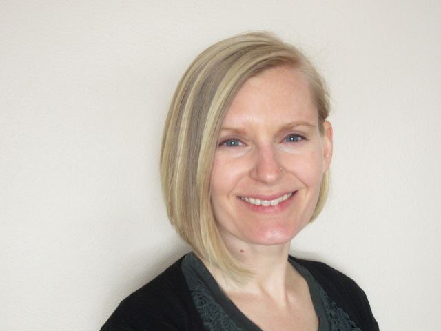
Celebrating Women In GIS: Nikki Hart By Nikki Hart
I am so pleased to be one of the newest members of the ORURISA Board, representing the Southern Oregon chapter. I hold a BA in Anthropology from Western Michigan University and worked for a time in Cultural Resource Management after college. When I came to Oregon in 2014, I knew that I wanted to reinvent my career. I'd been a stay-at-home mom for several years prior and had fallen into some dull office jobs previous to that. Maps have always held an intense fascination for me, and I realized that they are increasingly used to communicate information in engaging ways. I enrolled in Oregon State University's GIS certification program in 2015 and started an internship with the Rogue Valley Council of Governments several months later. Shortly after, I was hired as a permanent employee and have progressed in my role there, currently overseeing both GIS and drone technology for our organization. I enjoy developing and implementing geospatial solutions for our many partners, particularly for our smaller jurisdictions and local non-profits. I am so lucky to have discovered a career that gets me geeked every day, and am a dedicated advocate for the profession. Young women must see other women in professional technology careers and leadership roles. It is equally important for older women to recognize their capacity to learn new, highly specialized technical skills and have access to support and mentorship as they develop their careers.
I look forward to developing my career with inspiration from this incredible group of GIS professionals. |
|
|
|
|
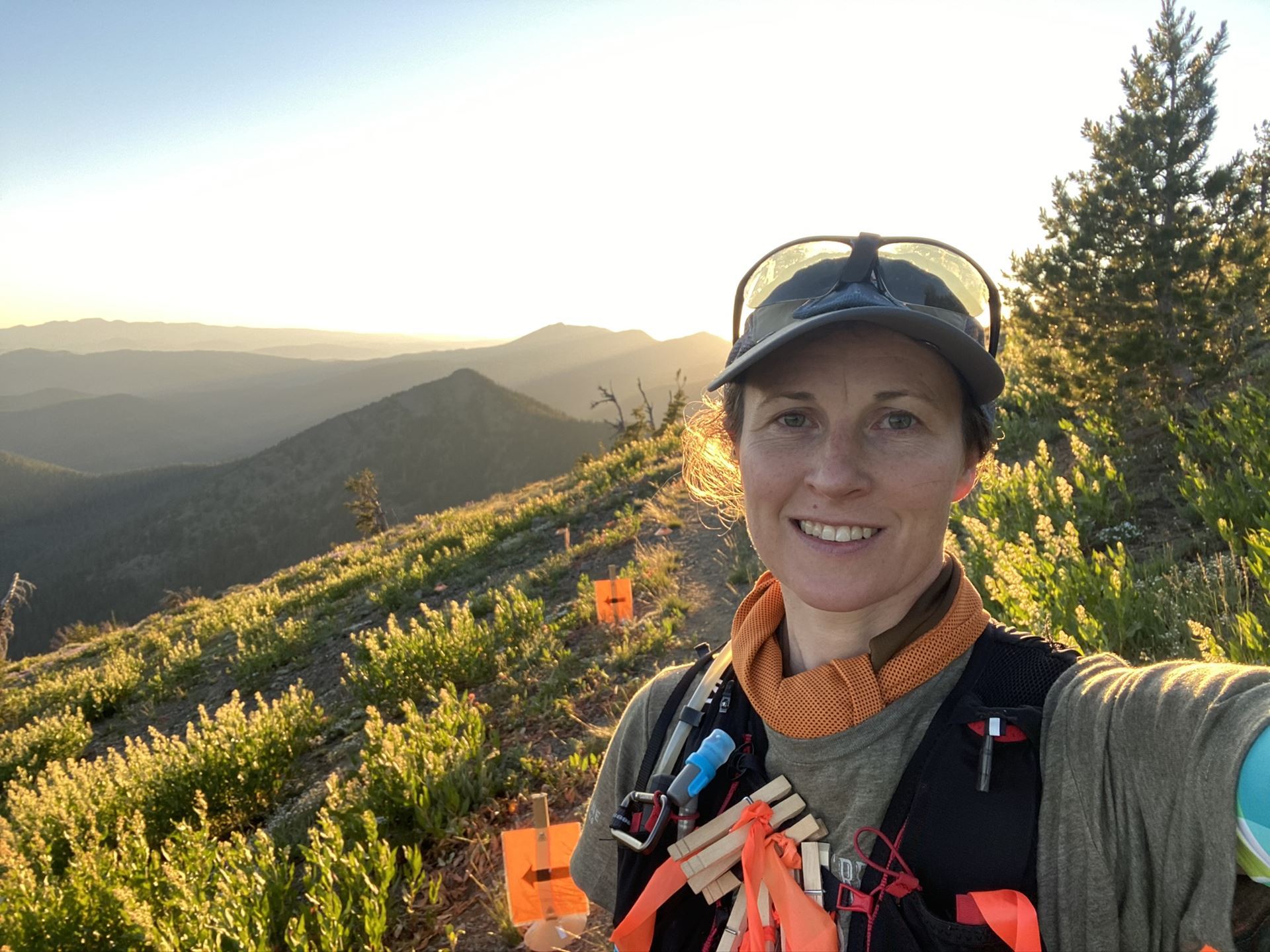
Celebrating Women In GIS: Alexa Todd Alexa Todd is a GIS Specialist in Metro’s Research Center. She first joined ORURISA in 2016 as the president of what is now the Emerging Professionals and is on her second term as an at-large board member. Alexa is the 2021 GIS in Action conference chair after participating in the planning since she was a grad student at PSU, taking on roles including the program chair and the volunteer coordinator. Alexa spends her time adventuring on trails with her partner and dog and accomplished her first 50-mile race in July on the PCT through the Mt. Hood National Forest.
|
|
|
|
|
Upcoming Events
ORURISA offers a FREE ArcGIS Portal User Summit
@Zoom on November 19, 2020 8:30 AM - 10:30 AM
The ArcGIS Enterprise Portal has become an important staple/backbone for government GIS & IT organizations to share, manage, secure, and analyze their data. Enterprise gives you complete control over your deployment, but navigating the full implementation for Enterprise & Portal can be daunting and technical at times. This Portal Summit is a peer to peer learning opportunity for government and other entities’ GIS & IT staff to share their experiences and best practices with implementing Portal. While the Portal Summit is not affiliated with Esri, there will be Esri staff on hand to help answer questions and develop a possible follow up workshop with ORURISA to address challenging topics that we unearth during the Portal Summit. We will have five panelists from Oregon local and state governments who are proficient in the implementation of Enterprise and Portal and will cover topics ranging from architecture, collaboration, governance, security, and data management strategies. The Portal Summit will be open to everyone, but the discussions will be targeted toward government staff. Please visit the ORURISA Events page for more information and registration details. https://www.orurisa.org/Events. |
|
|
|
|
2021 GIS in Action Annual Conference
The GIS in Action Conference committee is planning a virtual event for spring 2021. More information will available and emailed to you next month. Please visit the GIS in Action page for more information and registration details: https://www.orurisa.org/GISinAction. |
|
|
|
|
Meet Our New Board Members
President elect: Keith Massie
At large members: John Ruffing and Alicia Milligan
Keith Massie is a GIS Resources Manager at Roseburg: A Forest Products Company. Keith has been involved with the Oregon & Southwest Washington URISA Chapter in various roles for the past 20 plus years. He was the former co-chair of GIS In Action for seven years. His primary focus as a Chapter member is to facilitate GIS workshops that are affordable, relevant to our membership.
John is an ESRI account representative for Oregon and SW Washington. John has a long and excellent GIS career with an experience that involves working with many city governments. He brings a unique perspective to the ORURISA board. |
|
|
Alicia Milligan is currently a part-time Geography/GIS instructor at Portland Community College. Additionally, she is putting the final touches on her master's thesis in the Sense of Place in Mt. Hood National Forest for a Masters of Geography at Portland State University. She has a BS in Geography with a minor in Sustainable Urban Development and recently earned a GIS certificate from Portland State University. Alicia is the current president of Emerging Professionals (EP) and has been a board member of ORURISA EP for several years. Alicia is highly engaged in the GIS community and involved in many projects related to public participation GIS, humanitarian efforts, environmental issues, and community involvement. Being an advocate of outdoor recreation, Alicia spends her extra time bouldering, climbing, backpacking, hiking, and spending time in nature with her husband and two children.
As a woman in GIS, Alicia is very proud of her ability to be a role model for other women interested in science and GIS. She is an advocate for equitable opportunities and the expression of ideas for all interested in the geospatial world. |
|
|
|
|
Share Your GIS Story If you have a story to share, project to present, success to celebrate, comments or feedback please email Tara Kaur, Communications Director of ORURISA at: communications@orurisa.org.
|
|
|
|
|
|
|
|
|
This message has been sent to you by ORURISA
If you no longer want to receive these letters, you can unsubscribe at any time
|
|
|
|